


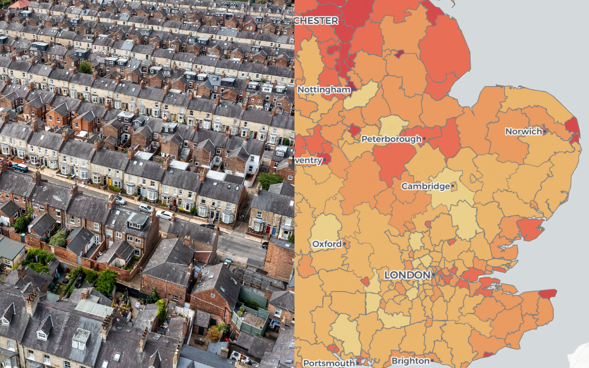
Premature mortality higher in most deprived districts
Premature mortality rates remain higher in poorest districts, with Blackpool and Manchester leading the national rankings for both deprivation and
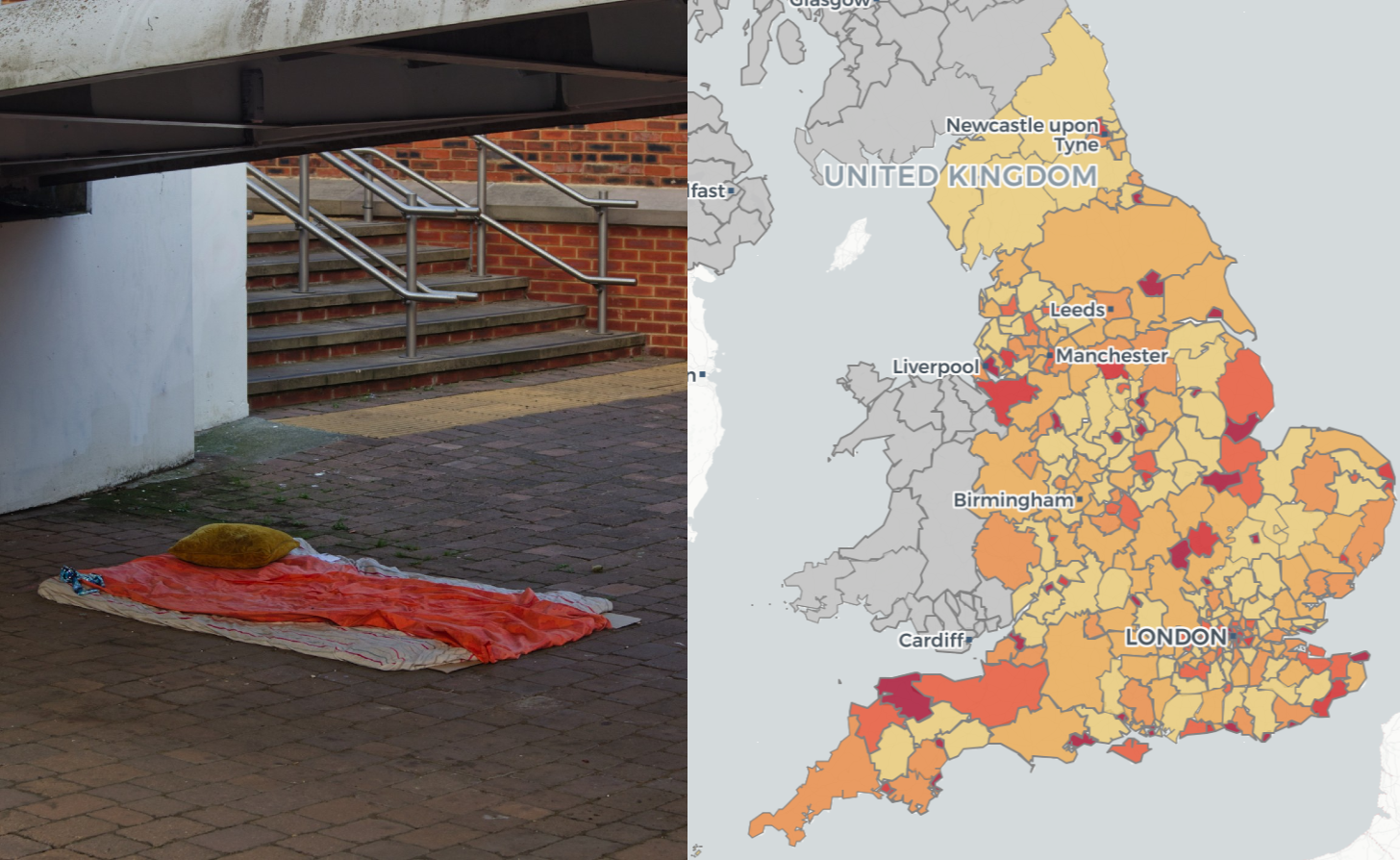
Homelessness figures surge following rough sleeping grant
New figures show increasing numbers of homelessness a year after the introduction of a local authority grant to support rough

Over 270,000 ECO measures installed in the last year as Reeves scraps scheme
Over 270,000 energy efficiency measures installed in the year to September 2025 under the Energy Company Obligation (ECO) scheme, as

Public consultations launched for devolution priority areas
Devolution priority areas have launched public consultations on reorganisation, as the government prepares to evaluate final proposals. Earlier this week,


Polimapper launches devolved election tools: Holyrood and Senedd Engage
https://vimeo.com/1142457854?share=copy&fl=sv&fe=ci Try Holyrood Engage 2026 will bring the first real test of the political temperature at a national level since

From Spreadsheet to Hansard: How Alzheimer’s Research UK’s Constituency Profiles Powered MP Speeches
Join Our Newsletter We’re often told that MPs love constituency-level data. For many organisations, the challenge isn’t convincing parliamentarians of its value—it’s
What’s new in the latest Polimapper release: Version 4.2
Over the past month, the Polimapper technical team has been hard at work implementing key improvements to enhance usability and
Flattening the Tiers: A comprehensive guide to the reorganisation of two-tier councils in England
England’s local government landscape is changing. Across the nation, the established two-tier system of councils is being re-drawn, sparking crucial