Why data-led stories matter to elected mayors
Elected mayors oversee wide-ranging portfolios that shape everyday life across their city regions.
Whether it is in illustrating how bus usage is falling in the wards with the highest employment deprivation or that affordable-housing demand outstrips supply around newly opened tram stops, a data driven approach can move your pitch from abstract to urgent.
Polimapper lets you surface and share such insights instantly so every briefing, meeting or email lands with unmistakable clarity.
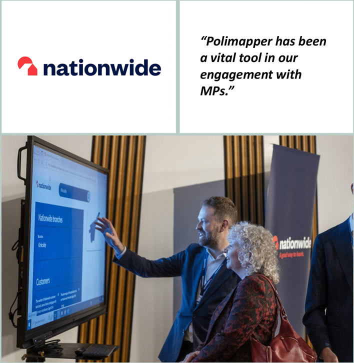
“Polimapper has been a vital tool in our engagement with MPs.”
– Nationwide

Common use cases for mayoral engagement
Pitching transport funding
Highlight congestion pinch points, overlay public-transport usage and demonstrate the economic cost of delays to argue for targeted investment in active-travel corridors or bus priority lanes.
Shaping the city-region plan
Map affordable-housing waiting lists against brownfield opportunities and regeneration zones to identify where new development delivers maximum social value.
Targeting public-health interventions
Combine air-quality readings with asthma hospital-admission rates to make a compelling case for clean-air zones or greener fleet procurement.
Strengthening community-safety proposals
Visualise violent-crime hotspots alongside CCTV coverage and youth-diversion projects to support bids for additional community-safety funding.
Driving economic-development bids
Showcase clusters of high-growth SMEs, skills shortages and transport connectivity to persuade mayors to back business-support programmes or enterprise zones.
If a dataset isn’t publicly available our team can advise on Freedom of Information requests or methods to convert raw figures into mayoral geographies.
How Polimapper gives you an edge with elected mayors
Say goodbye to overtly complicated dashboards
Local resonance at speed
Tailor every outreach email with maps and dashboards that mirror a mayor’s exact boundaries, showing why your issue matters to their constituents today.
Evidence that sticks
Replace dense spreadsheets with clear visuals that committees, journalists and busy mayoral advisers remember.
Seamless collaboration
Share dashboards with colleagues, partner organisations or the mayor’s office and keep everyone working from the same up-to-date evidence base.
Data confidence
Built for the UK political landscape, Polimapper integrates parliamentary constituencies, local authorities, devolved assemblies and mayoral regions out-of-the-box.
Key features
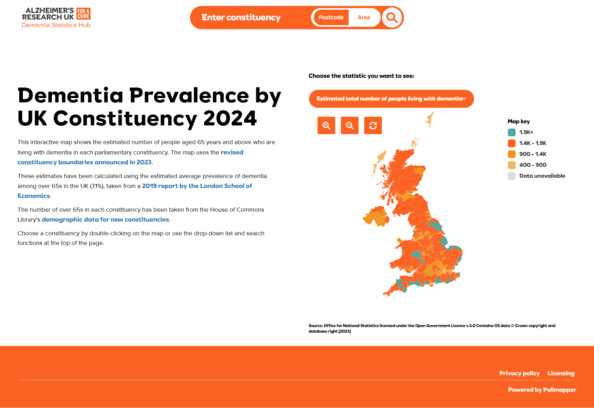
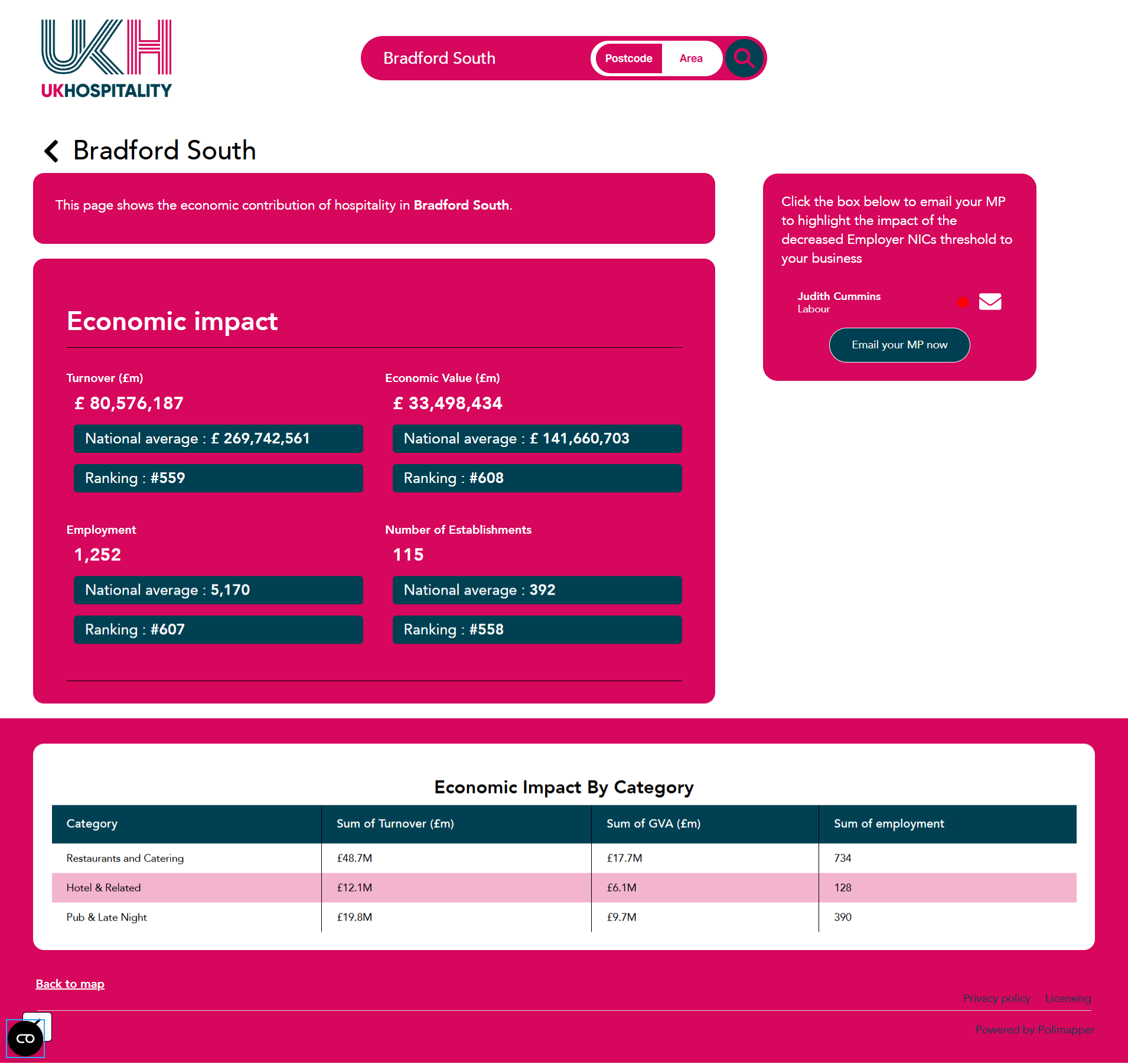
Interactive map dashboards – Navigate transport data, housing statistics or regeneration pipelines by mayoral region, local authority or Westminster constituency in seconds.
Clean, intuitive visuals – Heat maps, rankings and impactful charts make complex numbers digestible at first glance.
Unique, shareable URLs – Send a live dashboard link to a mayor’s office and let officials explore the data themselves—no attachments or large files.
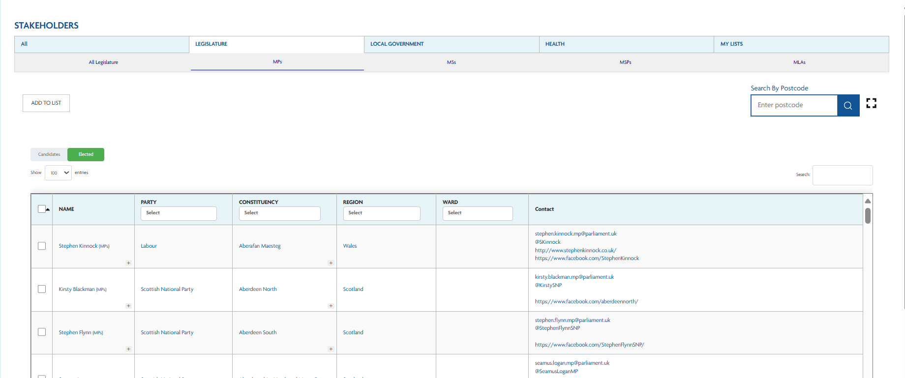
Stakeholder database and mail-merge – Reach every mayor, deputy mayor or portfolio holder straight from the platform with personalised emails.
Download-ready assets – Export map images for social, slide decks or printed briefings with one click.
Case Study:
How Nationwide demonstrates its branch commitment to MPs
Hear how Polimapper has made it much easier to present relevant data in a clear, impactful way, helping us showcase not only local-level insights but also the broader national picture.
Ready to put your mayoral engagement on the map?
Join the growing community of charities, trade bodies and corporates that rely on Polimapper to turn data into influence.
Speak to our team and try it for free today.