
Our purpose
You work every day to shape policy, influence decisions and secure tangible wins for the people you represent or work with.
Polimapper exists to make that mission easier.
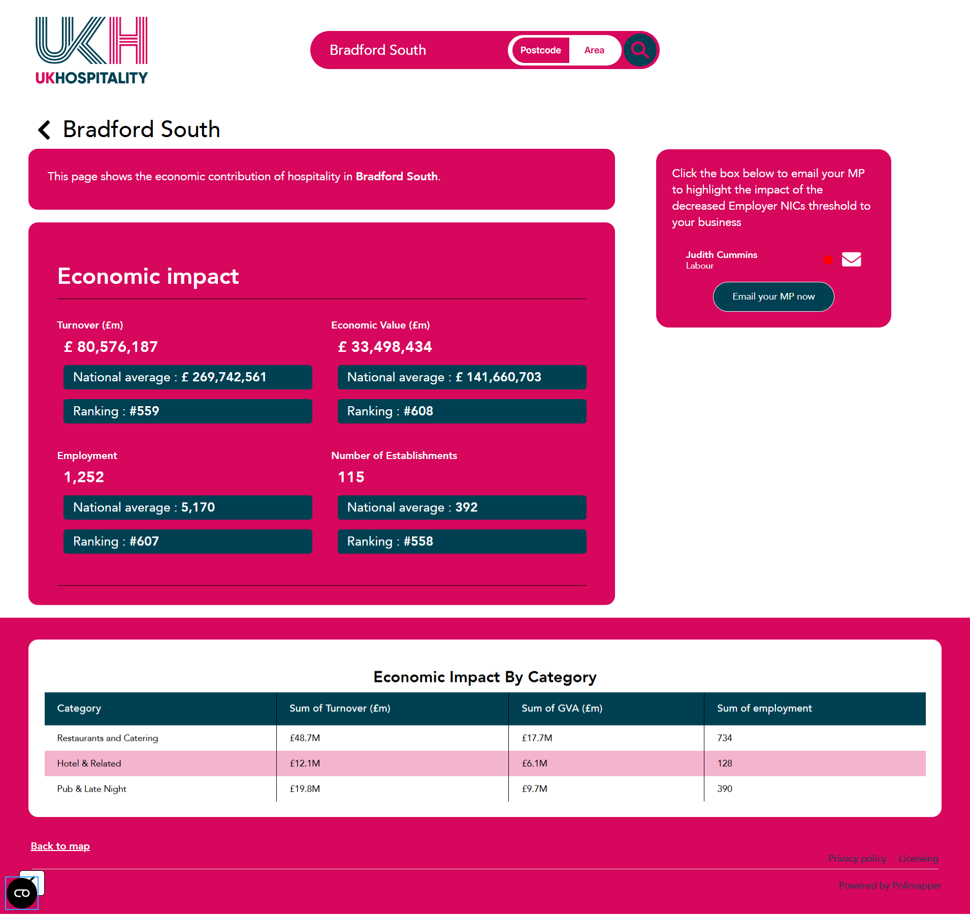
Combining our proven software with friendly in-house mapping consultancy, Polimapper transforms complex political and demographic data into clear interactive maps and dashboards that speak your stakeholder’s language.
By putting geographic insight at your fingertips, we empower you to tell a sharper story, reveal local impact instantly, and drive action in the corridors of power.
Why geography matters in advocacy
Policy decisions are rooted in place.
MPs, MSPs and MS’s all answer to constituencies, councilors are accountable to their ward electorates, whilst others from PCCs to Integrated Care Boards focus on defined regional areas.
When you frame your evidence within these boundaries, you give every stakeholder a reason to care.
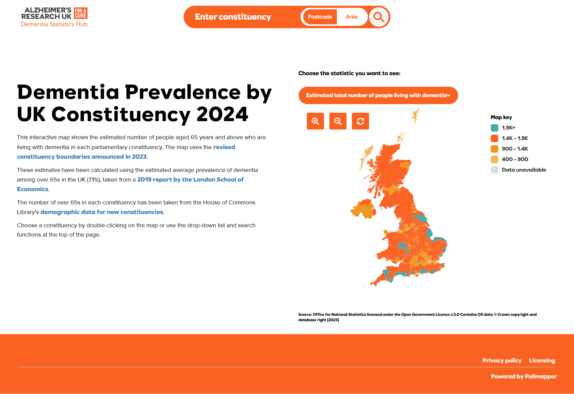
Polimapper lets you zoom from a national heat-map down to an individual ward in seconds, allowing you to land your arguments with relevant context, urgency and authority.
Who we serve
Say goodbye to overtly complicated dashboards
For well over a decade, Polimapper has been working with a wide range of clients from trade associations and charities, to corporates and trade unions, all with their own stories to tell through data.
Delivering mapping solutions that spread across political layers, from the European Union, through Westminster, the devolved assemblies, down to the local council level, Polimapper has become the undisputed market leader in geo-advocacy solutions.
Having established a significant customer base, we are proud of the way in which our growth has been routed in extremely high levels of customer retention.
Book a demo to find out how Polimapper can change the way you have conversations with political stakeholders, grabbing their attention and securing better outcomes.